Log in
All resources
Create a design
328 Free Images of 1896 Maps
prints by jan luyken in the rijksmuseum amsterdam
jan luyken
maps by jan luyken
maps in the rijksmuseum amsterdam
de nieuwe groote lichtende zee-fakkel (rijksmuseum)
history
historical
popular science monthly illustrations/volume 50
atlas geográfico y descripción geográfica y estadística de la república oriental del uruguay (1896)
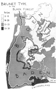
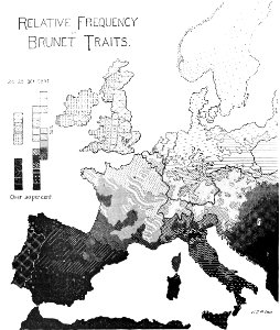
anthropometry
florence h. woolward - the genus masdevallia
de nieuwe groote lichtende zee-fakkel (rijksmuseum)
maps in the rijksmuseum amsterdam
historical
history
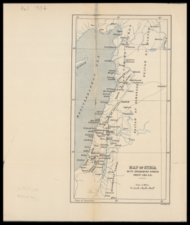
eran laor cartographic collection
edward weller
offizieller katalog der münchener jahres-ausstellung 1896 im kgl. glaspalast
moritz von schwind
maps by jan eduard wagner
1890s maps of czechia
prints, drawings and watercolours of the royal museums greenwich
1896 in art
a treatise on ore deposits (1896)
1890s maps of saxony
historical
history
in the volcanic eifel. a holiday ramble (1896)
old maps of eifel
prints by jan luyken in the rijksmuseum amsterdam
maps in the rijksmuseum amsterdam
john rocque's 1746 map of london
details of old maps of london
historical
history
19th-century maps of cornwall
19th-century maps of devon
in the volcanic eifel. a holiday ramble (1896)
old maps of eifel
in the volcanic eifel. a holiday ramble (1896)
old maps of eifel
through the subarctic forest (1896) by pike
1890s maps of alaska
through the subarctic forest (1896) by pike
1890s maps of alaska
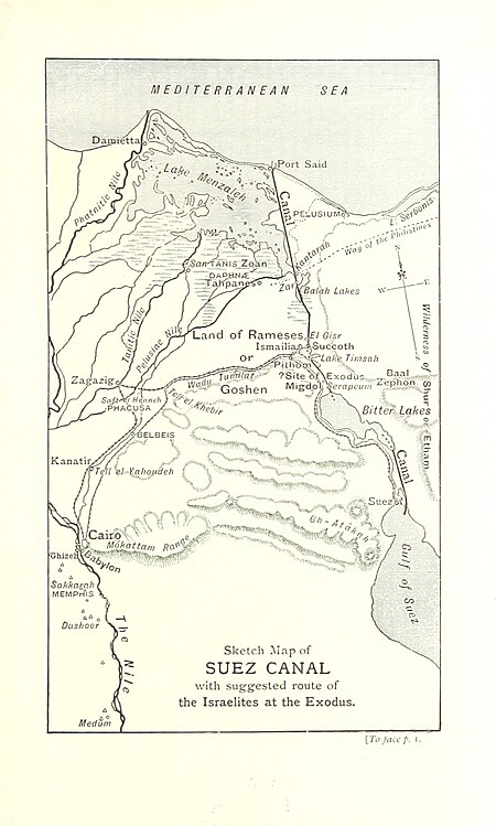
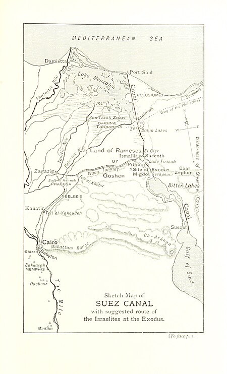
the land of the monuments (1896)
old maps of the suez canal
historical
history
corona and coronet (1898)
1898 maps of the world
fire and sword in the sudan (1896) by slatin
maps of the mahdist war
fire and sword in the sudan (1896) by slatin
old maps of khartoum
prints by jan luyken in the rijksmuseum amsterdam
maps in the rijksmuseum amsterdam
изъ исторіи москвы (1896)
sigismund's map of moscow
bern city map of 1638 by matthäus merian
baroque
prints by jan luyken in the rijksmuseum amsterdam
maps in the rijksmuseum amsterdam
unidentified locations in germany
a treatise on ore deposits (1896)
corona and coronet (1898)
1890s maps of japan
corona and coronet (1898)
travel maps of the world
mayville. an anglo-french pleasaunce (1896)
maps of le touquet-paris-plage
mayville. an anglo-french pleasaunce (1896)
maps of le touquet-paris-plage
mayville. an anglo-french pleasaunce (1896)
maps of le touquet-paris-plage
mayville. an anglo-french pleasaunce (1896)
maps of le touquet-paris-plage
prints by jan luyken in the rijksmuseum amsterdam
maps by jan luyken
fauna bl - mammalia
moose in art
plants
maps
plants
maps
prints by jan luyken in the rijksmuseum amsterdam
maps in the rijksmuseum amsterdam
historical
history
plants
maps
historical
history
prints by jan luyken in the rijksmuseum amsterdam
maps in the rijksmuseum amsterdam
historical
history
prints published by jan claesz ten hoorn in the rijksmuseum amsterdam
prints by jan luyken in the rijksmuseum amsterdam
historical
history
prints by jan luyken in the rijksmuseum amsterdam
maps in the rijksmuseum amsterdam
works by willem goeree in the rijksmuseum amsterdam
de republyk der hebreen
prints by jan luyken in the rijksmuseum amsterdam
willem broedelet
book covers from the british library mechanical curator collection
adolphe giraldon
historical
history
atlas geográfico y descripción geográfica y estadística de la república oriental del uruguay (1896)
old maps of departments of uruguay
atlas geográfico y descripción geográfica y estadística de la república oriental del uruguay (1896)
hydrographic maps of uruguay
atlas geográfico y descripción geográfica y estadística de la república oriental del uruguay (1896)
old maps of montevideo
atlas geográfico y descripción geográfica y estadística de la república oriental del uruguay (1896)
rail transport maps of uruguay
historical
history
french-language maps of japan
old maps of japan
historical
history
maps in the rijksmuseum amsterdam
nieuwe cronyk van zeeland
prints by jan luyken in the rijksmuseum amsterdam
maps in the rijksmuseum amsterdam
book covers from the british library mechanical curator collection
books about africa
prints by jan luyken in the rijksmuseum amsterdam
maps by jan luyken
book covers from the british library mechanical curator collection
adolphe giraldon
historical
history
de nieuwe groote lichtende zee-fakkel (rijksmuseum)
prints by jan luyken in the rijksmuseum amsterdam
historical
history
works by willem goeree in the rijksmuseum amsterdam
old maps of canaan
the land of the monuments (1896)
old maps of the suez canal
prints by jan luyken in the rijksmuseum amsterdam
maps by jan luyken
prints by jan luyken in the rijksmuseum amsterdam
maps by jan luyken
de nieuwe groote lichtende zee-fakkel (rijksmuseum)
prints by jan luyken in the rijksmuseum amsterdam
prints by jan luyken in the rijksmuseum amsterdam
maps by jan luyken
prints by jan luyken in the rijksmuseum amsterdam
maps by jan luyken
prints by jan luyken in the rijksmuseum amsterdam
old maps of suriname
bequest of simon emmering
art nouveau
prints by jan luyken in the rijksmuseum amsterdam
siege of groningen (1594)
prints by jan luyken in the rijksmuseum amsterdam
siege of groningen (1594)
historical
history
prints published by pieter van der aa
nieuwe cronyk van zeeland
prints by jan luyken in the rijksmuseum amsterdam
maps in the rijksmuseum amsterdam
prints by jan luyken in the rijksmuseum amsterdam
maps in the rijksmuseum amsterdam
prints by jan luyken in the rijksmuseum amsterdam
maps in the rijksmuseum amsterdam
prints by jan luyken in the rijksmuseum amsterdam
maps in the rijksmuseum amsterdam
de nieuwe groote lichtende zee-fakkel (rijksmuseum)
maps in the rijksmuseum amsterdam
de nieuwe groote lichtende zee-fakkel (rijksmuseum)
maps in the rijksmuseum amsterdam
europe in storm and calm (1885)
1885 maps of europe
de nieuwe groote lichtende zee-fakkel (rijksmuseum)
maps in the rijksmuseum amsterdam
maps in "the danish ingolf-expedition"
crustacea malacostraca (1908)
photographs of suriname in the rijksmuseum amsterdam
de nieuwe groote lichtende zee-fakkel (rijksmuseum)
old maps of stavanger
old maps of rogaland
prints by jan luyken in the rijksmuseum amsterdam
maps in the rijksmuseum amsterdam
de nieuwe groote lichtende zee-fakkel (rijksmuseum)
old maps of yucatán
atlas geográfico y descripción geográfica y estadística de la república oriental del uruguay (1896)
atlas geográfico y descripción geográfica y estadística de la república oriental del uruguay (1896)
atlas geográfico y descripción geográfica y estadística de la república oriental del uruguay (1896)
agriculture in uruguay
old maps of møre og romsdal
stadlandet
historical
history
de nieuwe groote lichtende zee-fakkel (rijksmuseum)
maps in the rijksmuseum amsterdam
de nieuwe groote lichtende zee-fakkel (rijksmuseum)
maps in the rijksmuseum amsterdam
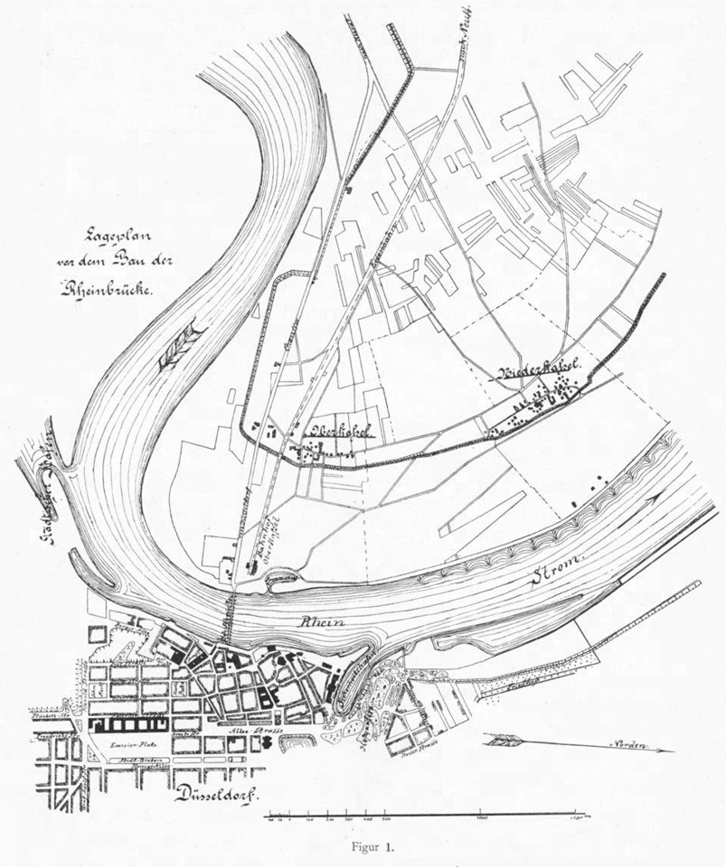
history of the united states from the compromise of 1850 to the final restoration of home rule at the south in 1877 (1893)
battle of hampton roads
101 - 200 of 328
Next page
/ 4